| 일 | 월 | 화 | 수 | 목 | 금 | 토 |
|---|---|---|---|---|---|---|
| 1 | 2 | 3 | 4 | 5 | 6 | |
| 7 | 8 | 9 | 10 | 11 | 12 | 13 |
| 14 | 15 | 16 | 17 | 18 | 19 | 20 |
| 21 | 22 | 23 | 24 | 25 | 26 | 27 |
| 28 | 29 | 30 | 31 |
- 태화강 해오라기.
- 티스토리챌린지
- 명촌 억새숲
- 태화강 수달
- 태화강국가정원 봄꽃축제
- 태화강 해오라기
- 문주란 꽃
- 울산 태화강 국가정원의 가을풍경
- 울산의 가을
- 오블완
- 태화강 국가정원 국화원
- 태화강 국가정원의 여름풍경
- 태화강의 여름풍경
- 문수 체육공원
- 태화강 억새숲 국가정원 코스모스꽃
- 흰날개 해오라기.
- 태화강 국가정원
- 태화강 누치떼
- 태화강의 여름조류.
- 태화강의 여름 풍경.
- 태화강국가정원
- 왜가리떼
- 태화강국가정원의가을
- 태화강
- 태화강국가정원의 가을.
- 태화강 국가정원 봄꽃축제
- 태화강의 백로떼
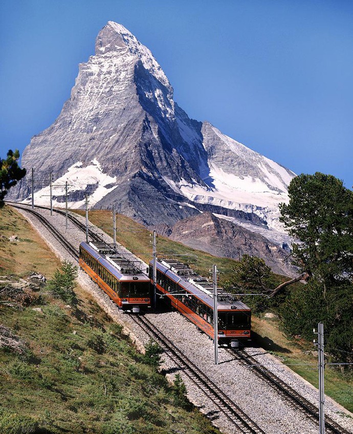
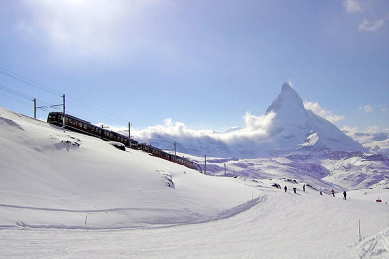
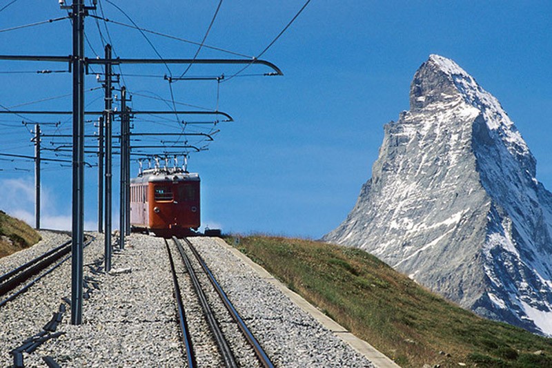
- 태화강국가정원의 억새숲
- 튜립나무꽃
- 태화강 국가정원의 가을
- Today
- Total
바람따라 구름따라
스위스의 특이한 산악철도 5 본문
At the end of the XIX century to the "roof of Europe" in the Alps have become like mushrooms appear mountain railways,
many of which were at the time the engineering marvel.
Underground station in the depths of towering peaks, spiral tunnels and viaducts, trains, scrambling with a bias of 40% at the height of kilometer
- we have selected for you the five most unusual historic railways of Switzerland.
(Total 73 photos)
Source: onliner.by
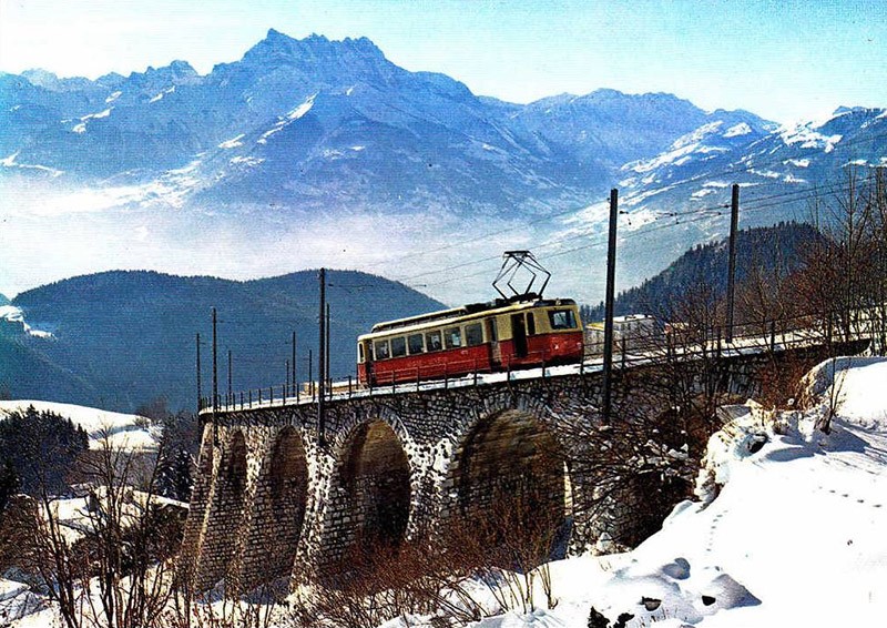
1. For the second half of the XIX century the Swiss realized that along with the famous banks of the main competitive advantage of their small country is
Amazing alpine nature. However, travelers still had to somehow bring in remote highland areas.
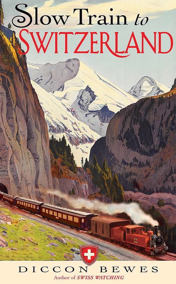
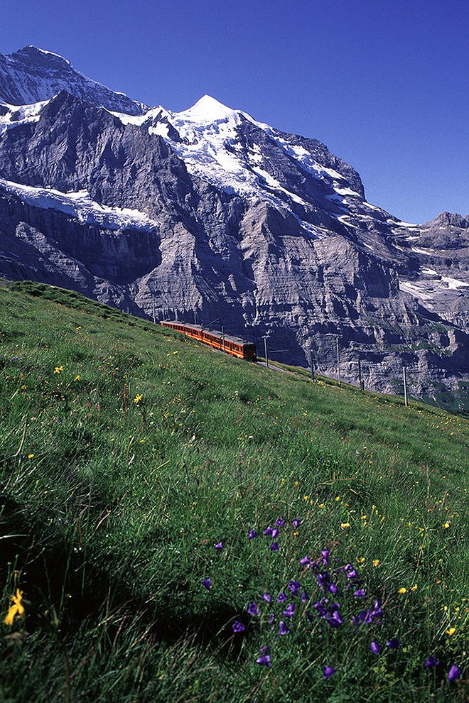
2. In the last quarter century, technological progress is finally allowed to find suitable engineering solutions: the new luxury hotel on the slopes of the Eiger, the Matterhorn and the Jungfrau travelers and skiers had to deliver the first steam and then electric traction by means of rail transport.
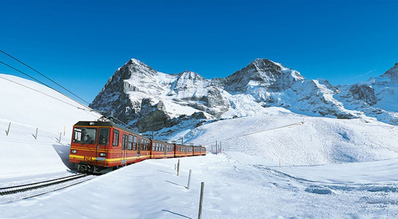
Most alpine railways in Europe - Yungfrauban
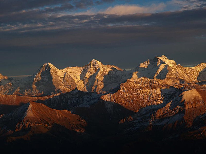
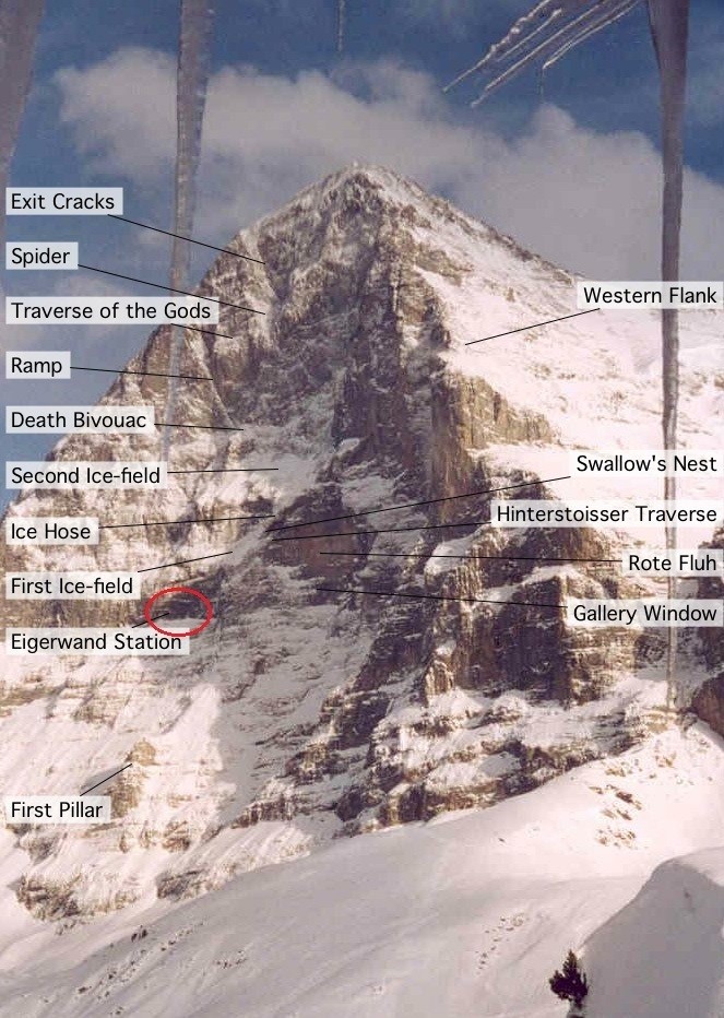
3. Eiger, Mönch and Jungfrau - the most famous mountain triad Bernese Oberland, the dream and the curse of many climbers.
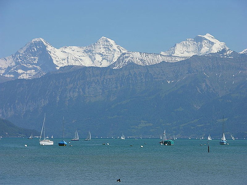
4. Ever since the 1860s, there were plans for the construction of the railway, which was to go straight through the thickness of the first two peaks and finish of the Jungfrau, the highest of them (4158 meters).
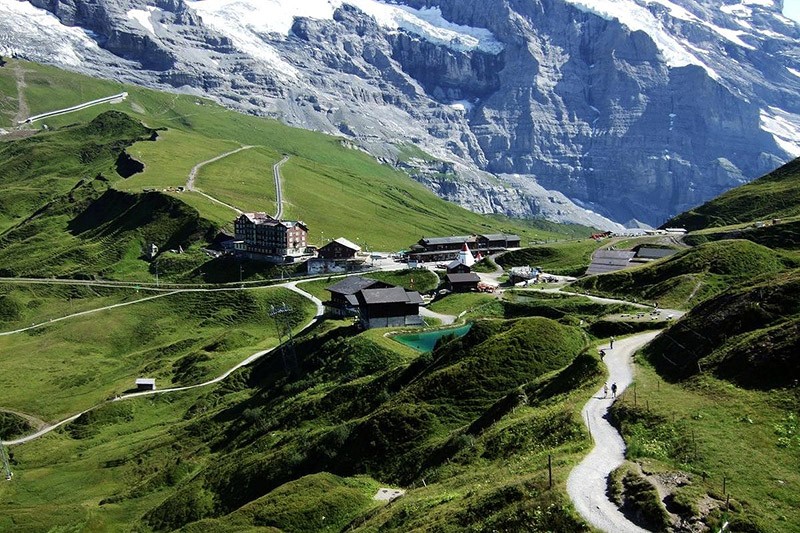
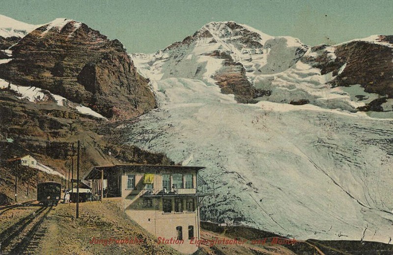
5. For various (mostly financial and engineering) reasons for the project could proceed only three decades later. In 1896, the Swiss businessman Adolf Guyer-Zeller began construction of a 9-kilometer line, which takes as its origin from pre-existing in the pass Kleine Scheidegg at the Eiger train station.
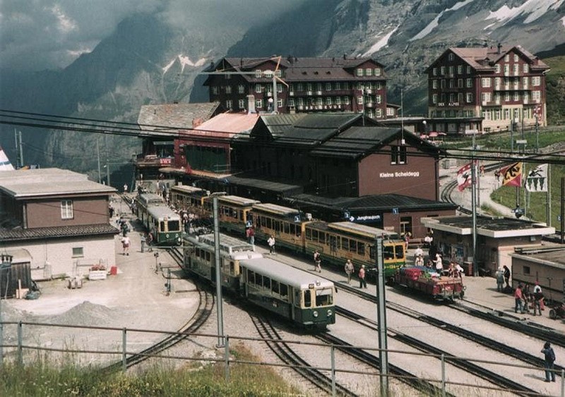
6. It would seem that the length of the new road is not impressive, especially in comparison with the 1000 kilometer Alpine design Chinese. However, in this case, there was quite a different meaning: Yungfrauban erected on more than 100 years earlier, with the appropriate technology and by private initiative. Lines had to overcome nearly vertical drop of 1,500 meters, with 7 of 9 kilometers of its length it was necessary to pierce right through the array of the Eiger and Mönch.
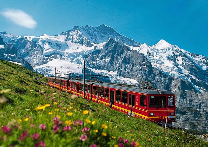
7. The tunnel was built as many as 14 years, from 1898 to 1912, initially around the clock in three shifts. In conducting blasting killed several workers, and in 1899 the process stalled after the death of the main investor of Adolf Guyer-Zeller. And had to change the original route of the road.
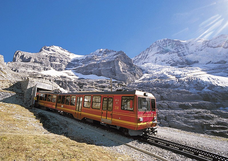
8. Yungfrauban was terminated at the summit of Mount Jungfrau, but because of the subsequent death of the mastermind of the project financial difficulties, and complex geological conditions in the intended end point of the road just brought up the Jungfraujoch saddle between the Mönch and the Jungfrau.
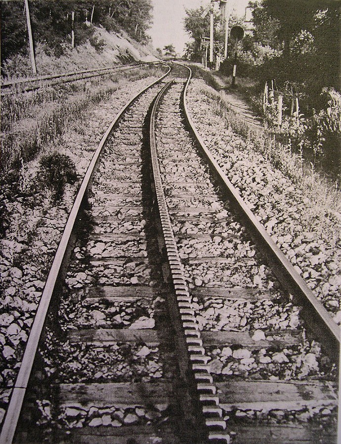
9. Of course, the usual build rail line in this case was not possible. Just 9 kilometers train had to climb 1393 meters from the pass Kleine Scheidegg (2061 meter above sea level) to the Jungfraujoch (3454 m). For similar upgrades needed to build a rack railway.
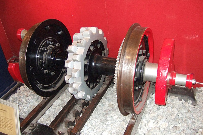
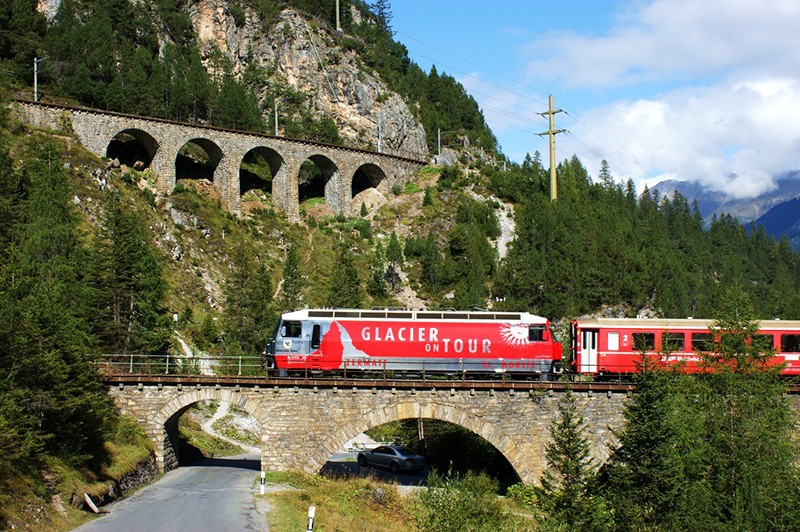
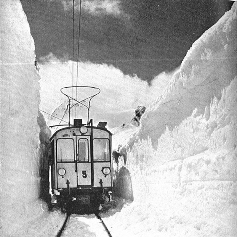
10. These highways are equipped with an additional (third) rack rails, for which clings to one or two gears as installed already on the rolling stock. The technology, special spread just in Switzerland, where there are several dozen similar lines, makes it relatively easy and safe to overcome the steep mountain slopes.
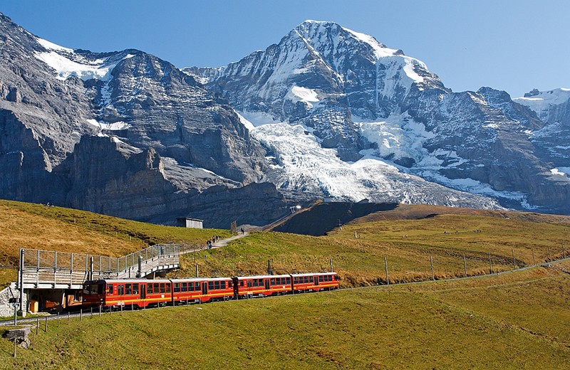
11. Yungfraubana was chosen meter gauge (width - 1000 mm), the line was originally electrified (using three-phase).
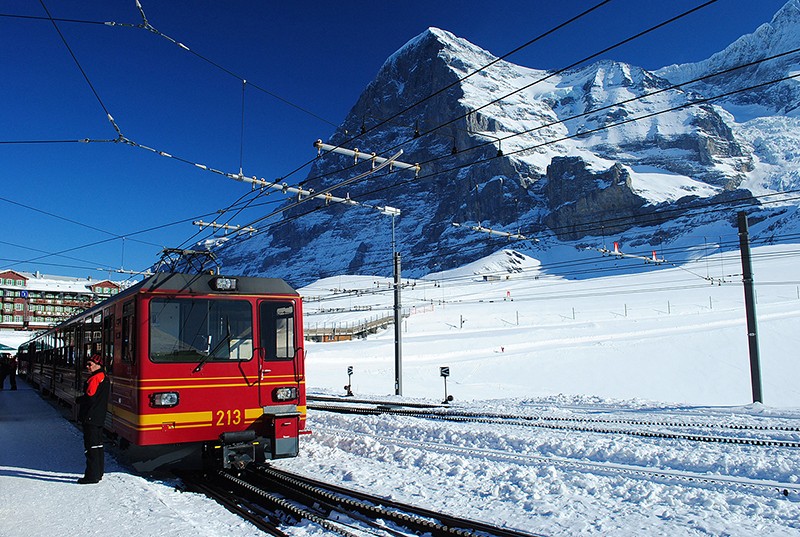
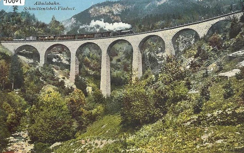
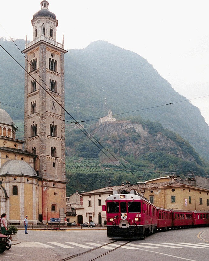
13. The first two kilometers it overcomes the surface of the earth. At the foot of the Eiger, on the background of her famous North Wall, which claimed the lives of many climbers, arranged the first station "Aygergletcher" ("Eiger Glacier").
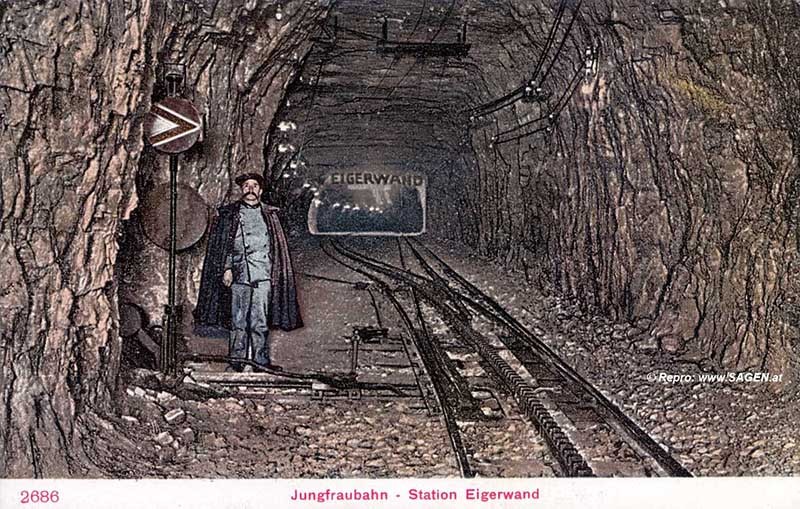
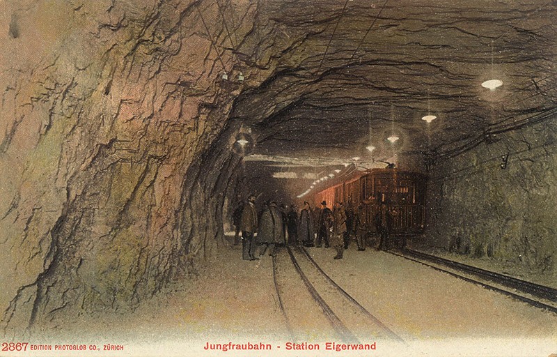
15. The remaining three underground station road, or rather piedmont. As the gnomes of the epic "The Lord of the Rings", the builders erected Yungfraubana straight into the mountain station complex, not simple, and combined with the Lookouts. Station "Aygervand" ("The Wall of the Eiger") is located in the midst of the most northern wall and was opened in 1903.
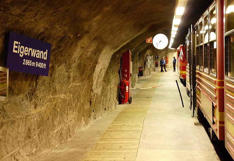
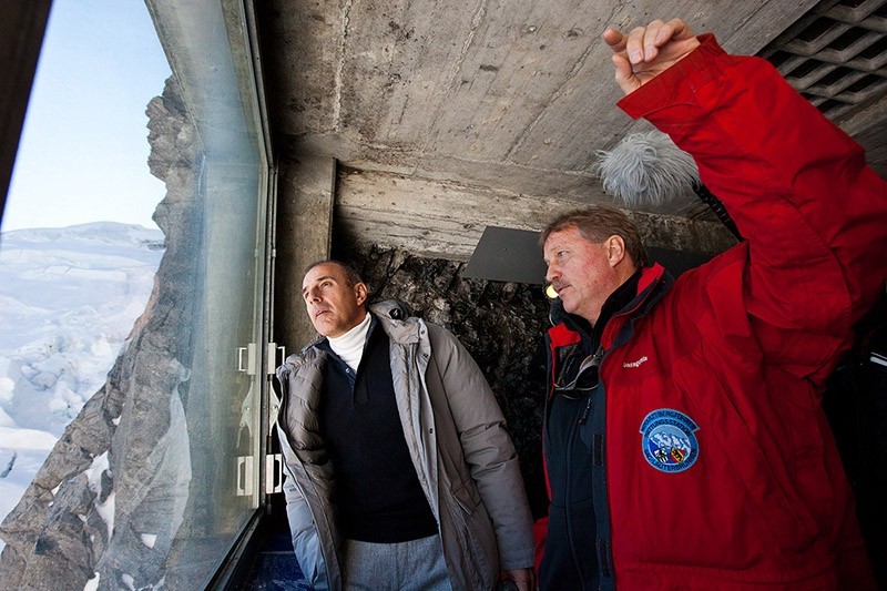
17. Train on the way upstairs stayed here for five minutes. With passenger platforms arranged outputs to the observation windows, of which 2865 meters altitude with fantastic panorama of the valley of Grindelwald. These windows at one time used to rescue climbers heads to conquer the North Face of the Eiger, but do not calculate the forces.
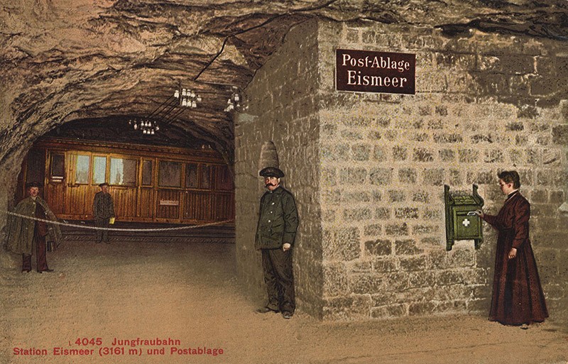
21. In 1905, at the height of 3158 meters again still in the depths of the Eiger, but at its south-eastern slope of the station opened "Aysmeer" ("Sea Ice").
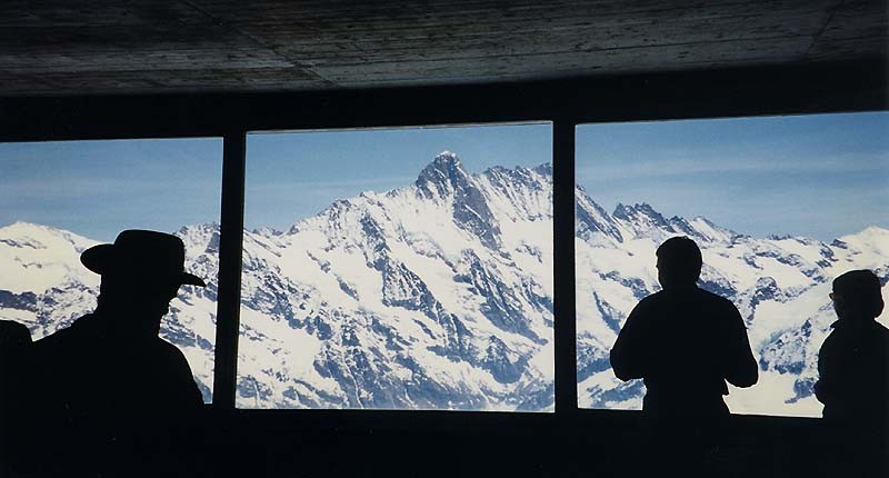
22. Here, the trains also make a five-minute stop, so that passengers can enjoy longer valley and Lower Grindelwald Glacier. Those interested can send directly from the interior of one of the most famous alpine peaks postcard home.
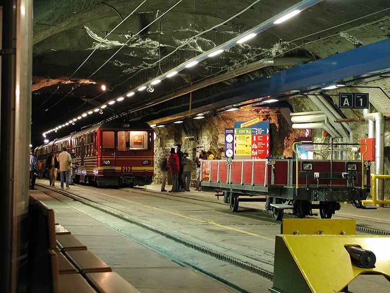
23. Finally, the third (and became final) station Jungfraujoch earned only in 1912. Located on the eponymous mountain pass between the mountains Mönch and Jungfrau, she took a height of 3454 meters, becoming, thus, the most mountainous part of the train station across the world. That is why it is nicknamed the "Top of Europe".
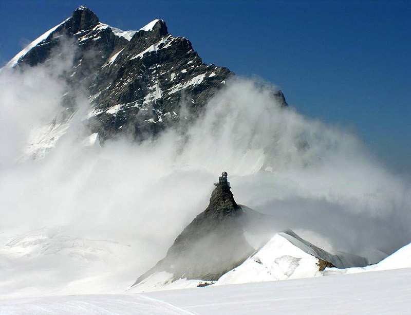
24. Here tourists can come to the surface, where there are several tourist sites: Observation Decks with panoramic views of the surrounding area, including the longest Alpine glacier Aletsch, restaurants, a museum, a post office, an ice palace.
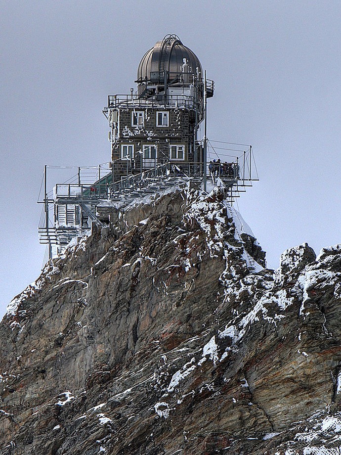
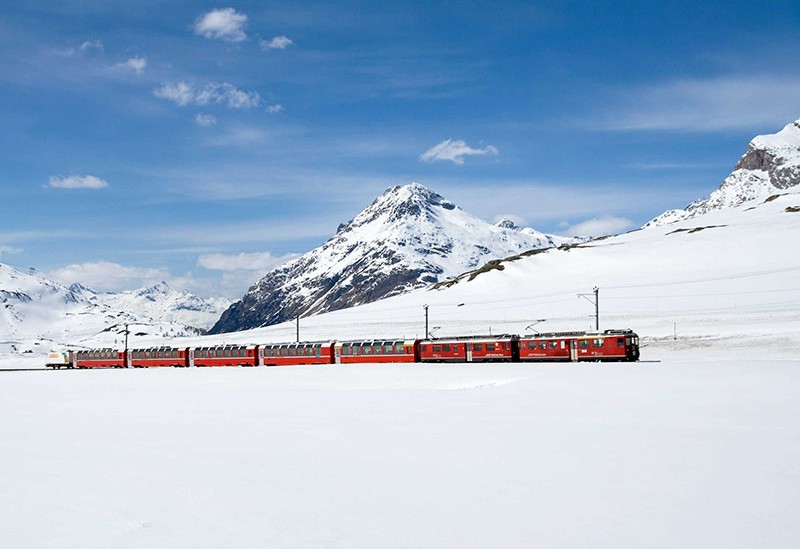
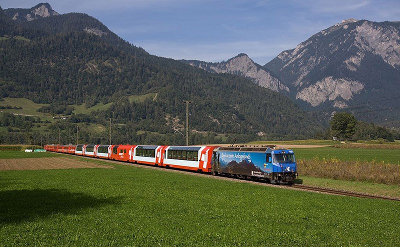
25. Here, at an altitude of 3571 meters and is an astronomical observatory "Sphinx", available to the public.
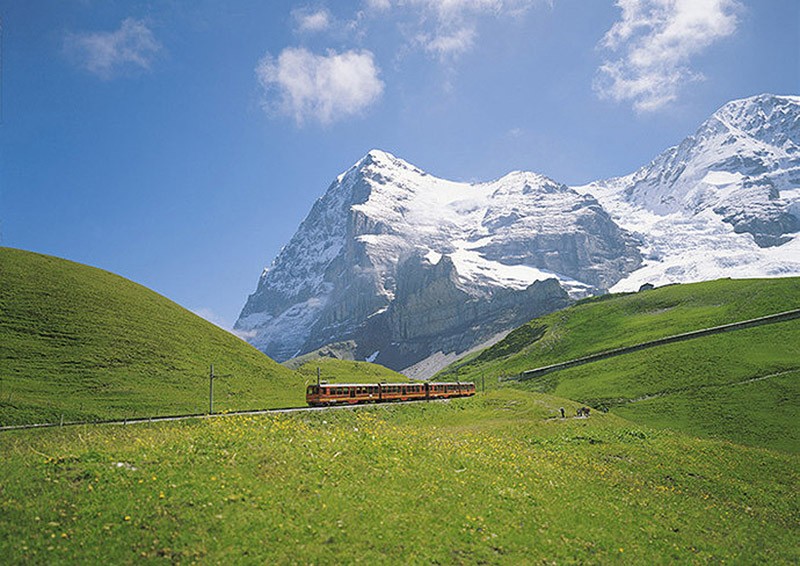
26. Yungfrauban, of course, first of all - this is a popular tourist attraction. Dvuhvagonnye compounds annually carry more than half a million people.
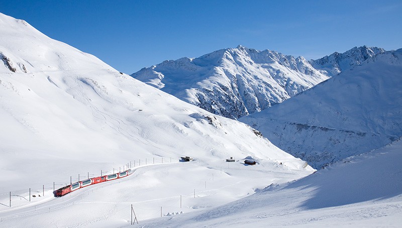
Most mountainous outdoor railroad Europe - Gornergratbahn
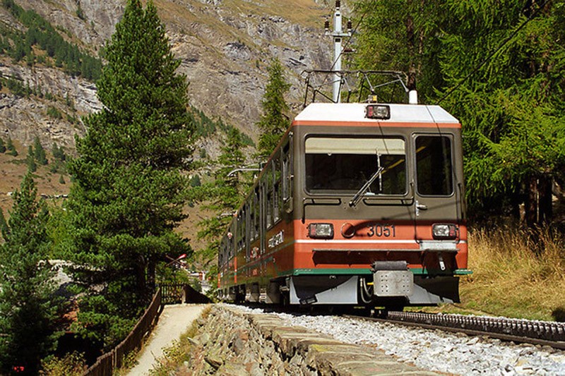
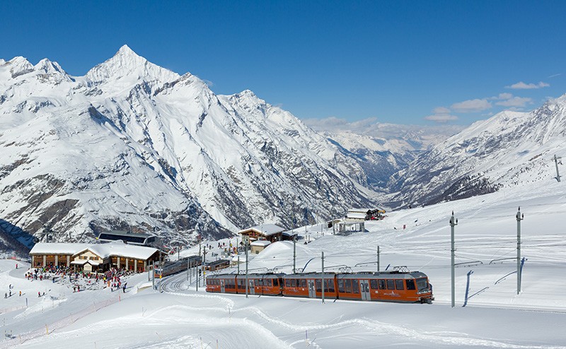
28. Yungfrauban is the highest railway in Europe, but seven of her nine kilometers laid in tunnels. In Switzerland, in the canton of Valais in comparable altitudes there is one, of course, also rack railway, but is almost completely paved surface.
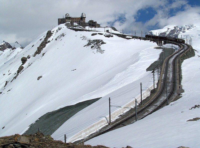
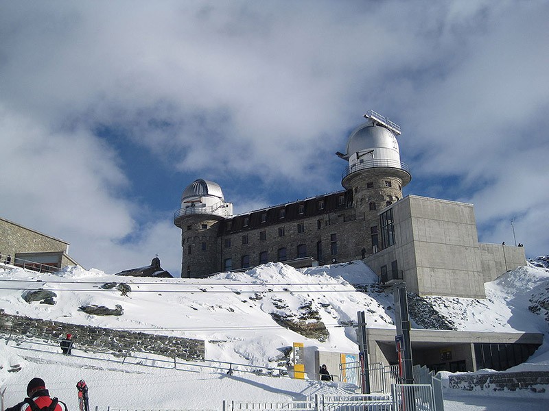
30. Its length is also a little more than nine miles, but because of the short length of the tunnels built it much faster. Work began in 1896 and lasted only about two years. Partially double-track line with a gauge of 1000 mm joined existed at the height of 1604 meters of the train station in Zermatt with the mountain range Gornegrat (3089 meters), where there was a hotel Kulm.
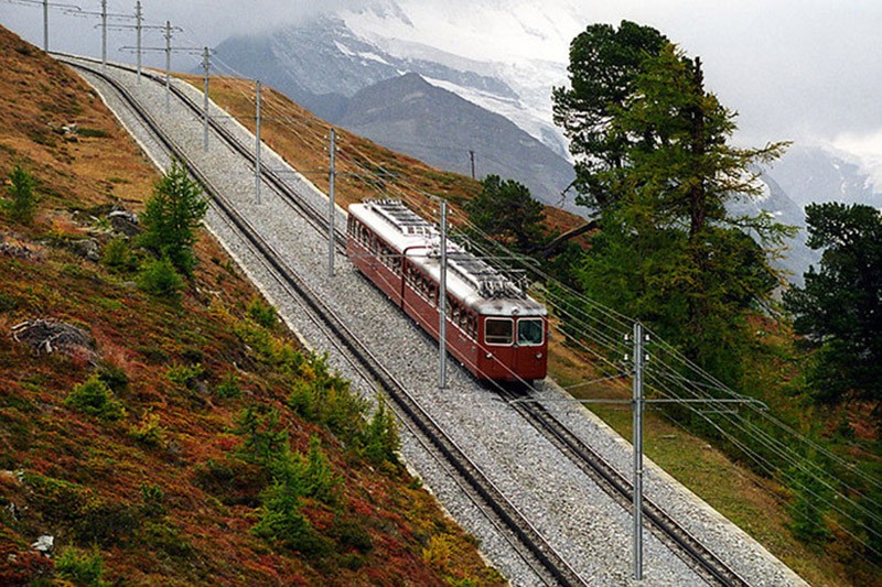
32. on the line, which is the maximum slope of 20%, there are four of the tunnel (the longest - just 179 meters), two viaducts and covered gallery length of 770 meters, which appeared in the 1940s on the site of the most avalanche.
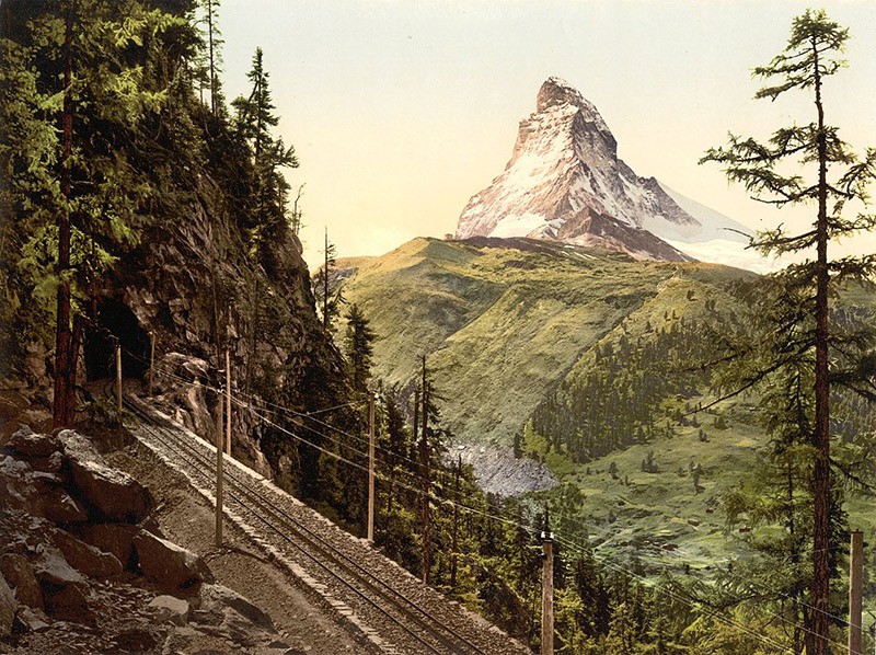
34. In a significant portion Gornegratbana picturesque backdrop for her is a mountain Matterhorn, one of the most famous alpine peaks.
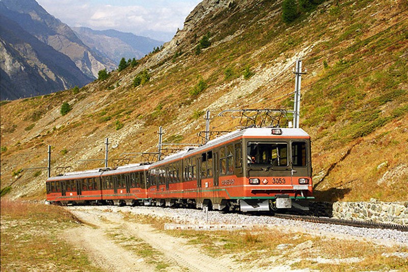
37. The total vertical drop on the line is 1485 meters, that is even more than Yungfraubane. Gornegratban electrified line (she even became the first in Switzerland to the rack railway electric traction), her six stations (many of them are close to the hotel). Dvuhvagonnye compositions able to transport about 2.5 thousand. Passengers per hour.
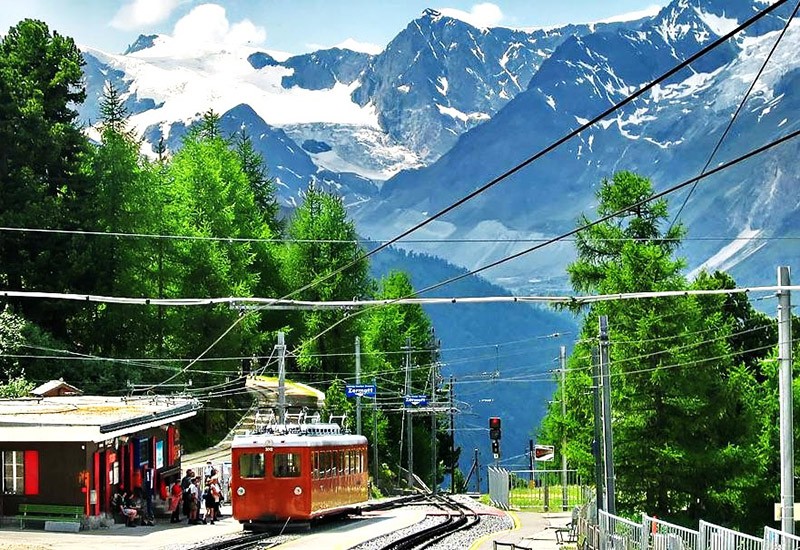
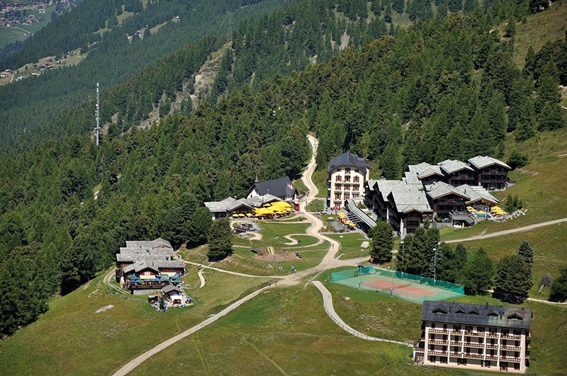
39. Another interesting object on this road is Riffelalptram. In fact, this very brief (only 675 meters) tram line, which in the summer transports hotel guests Riffelalp Grand Hotel Riffelalp station direct to the hotel.
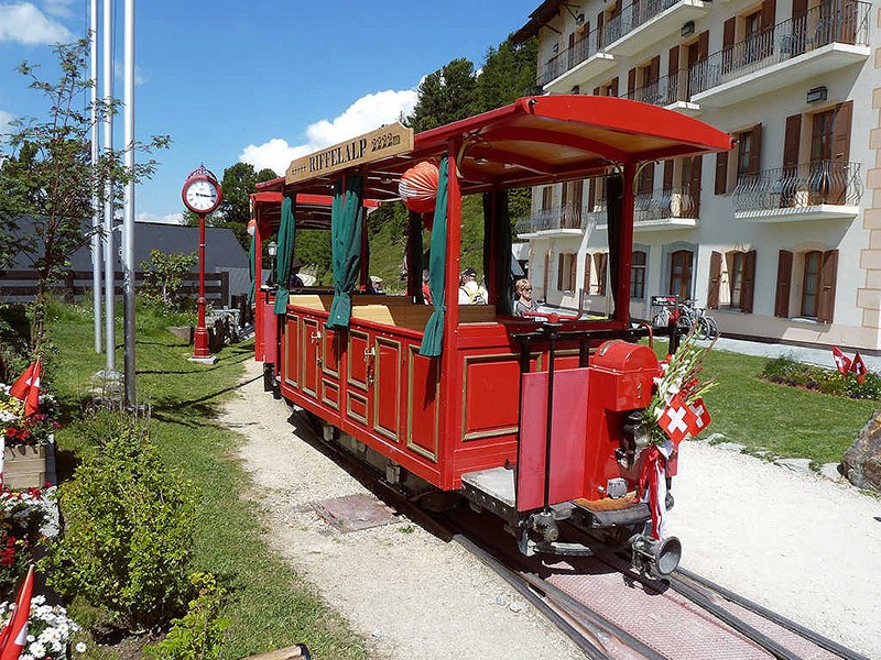
41. Serve single-track branch (track width - 800 mm) only two open trailer running on battery and built in 1899.
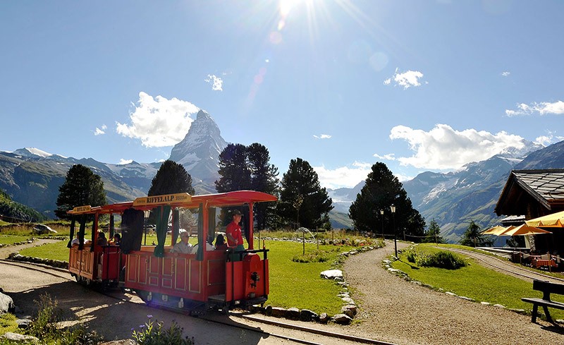
42. Despite the general view Riffelalptrama several toy, it is considered the highest mountain tram line in Europe: the average height above sea level is 2210 meters.
The steepest railway in the world - Pilatusban
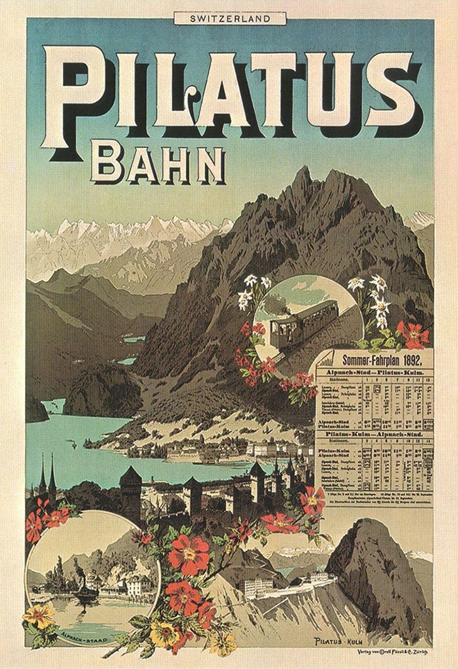
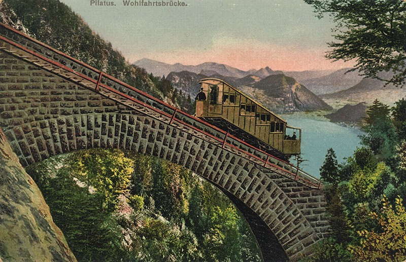
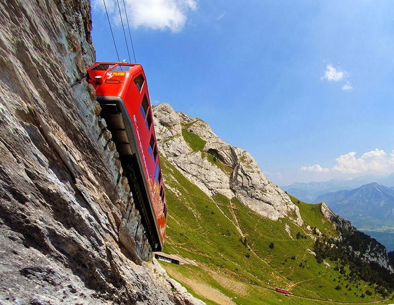
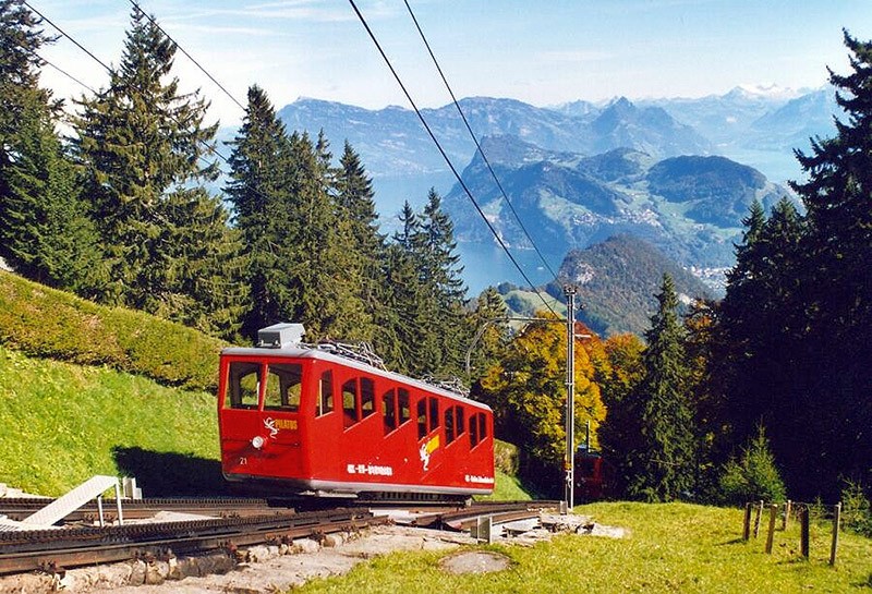
43. In the Jungfrau Railways and Gornergrat maximum slope of 25 and 20%, respectively. This is certainly not the record figures, which allows for gear. In 1889, in the Canton of Obwalden, Central Switzerland, opened a line linking the town with one of Alpnachstad mountaintops Pilatus above Lake Lucerne.
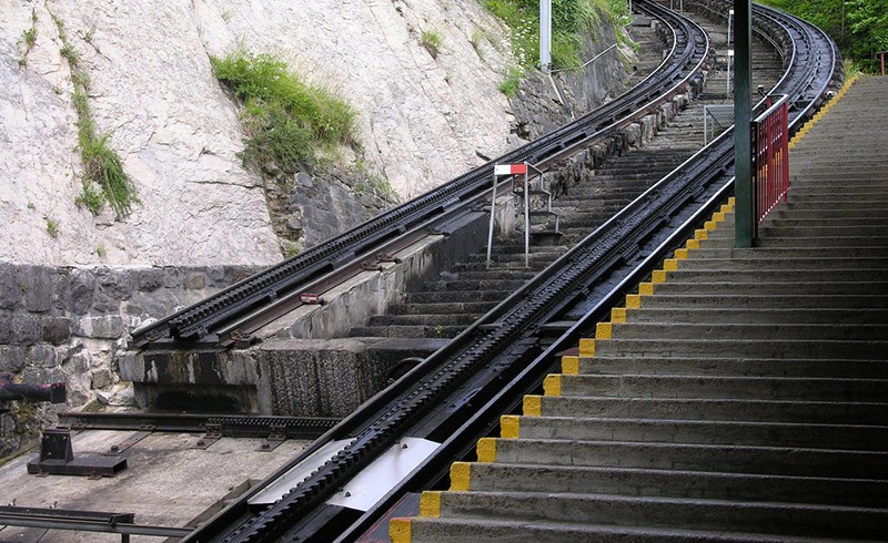
45. The average slope Pilatusbana is 35%, and the maximum - 48% (!). To ensure such a steep climb was not suitable even normal gear when the rail wheel had a vertical connection.
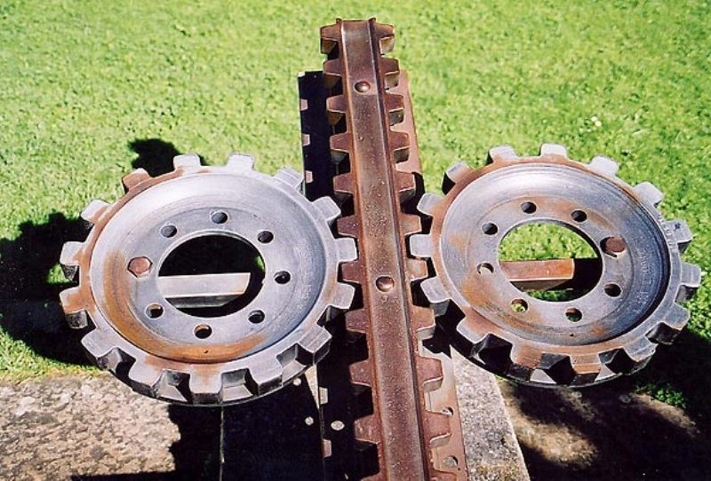
46. The engineer Eduard Locher offered an elegant solution: double system (two rails and two wheels) and expand it horizontally.
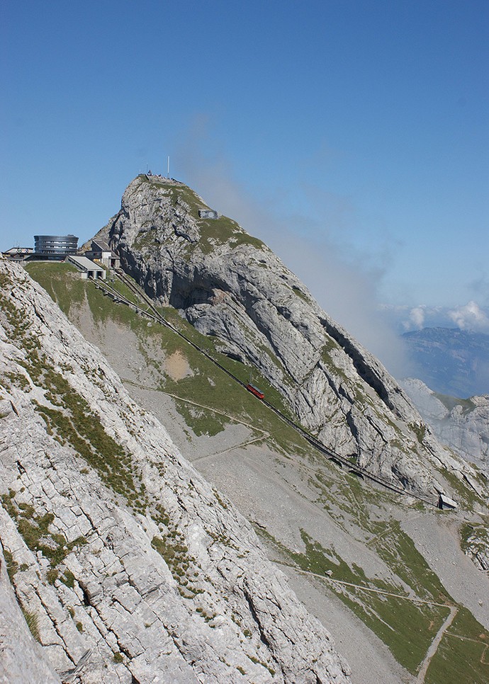
47. This decision not only allowed to eliminate the threat soskakivaniya wheel and rail, but also to ensure the sustainability of wagons during strong winds, frequent in the area.
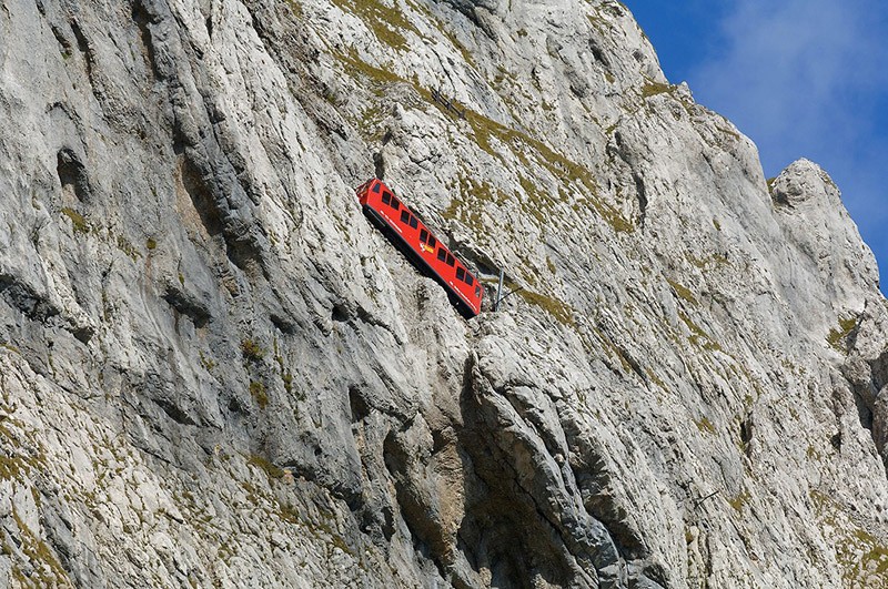
49. The length of the lines with a gauge of 800 mm - only 4.6 kilometers. For half an hour one of the ten cars with a capacity of 40 people each overcomes a height of 1629 meters.
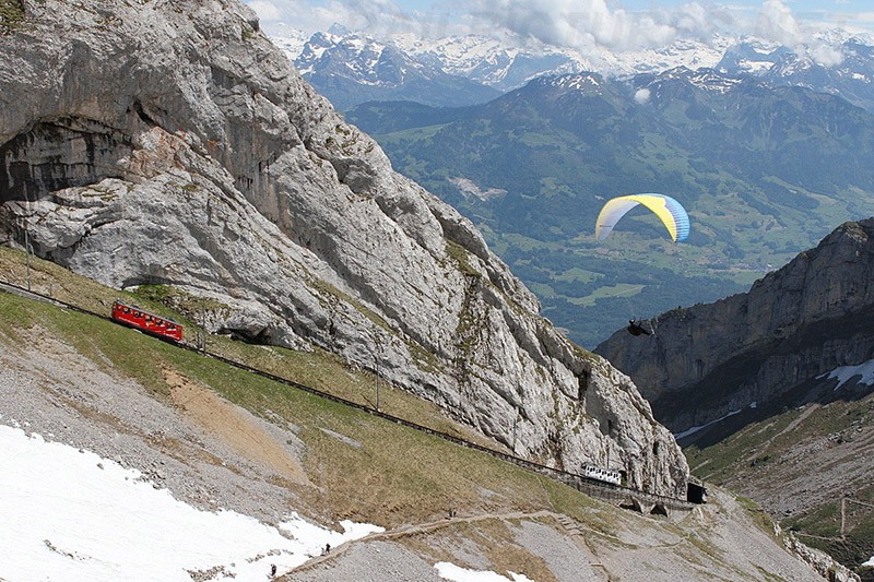
50. At the end of the arranged multiple tunnels. Originally used for the movement of steam traction, since 1937 the line was electrified.
Furka-line locomotive Bergshtreke
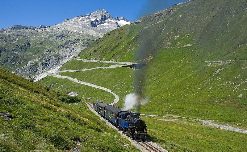
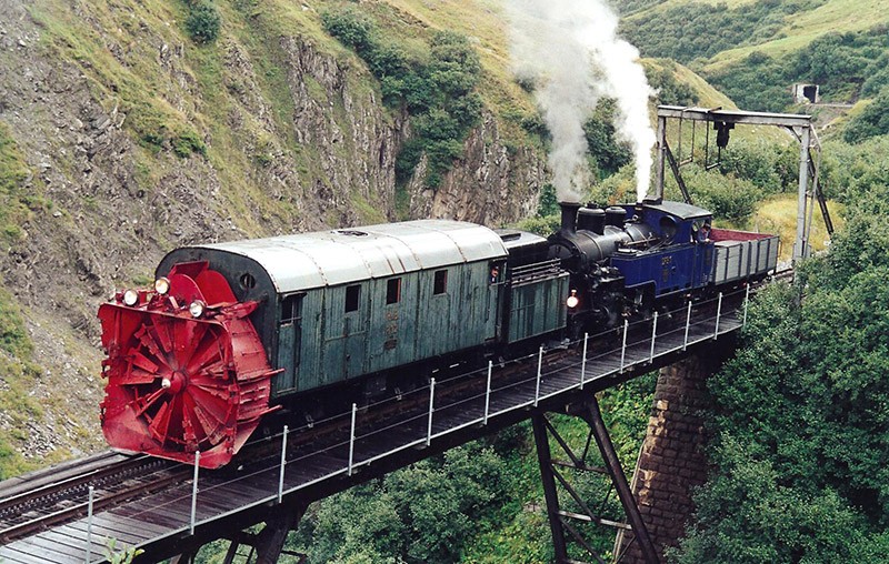
51. Unlike Pilatusbana, has long since been electrified, cog railway, connecting towns Realp and Oberwald in the south of Switzerland, still uses the locomotive traction.
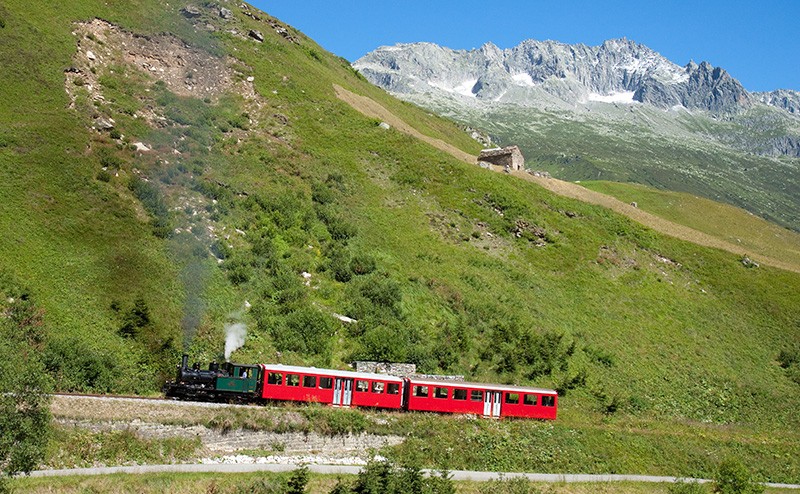
52. Line at its highest point crosses the Furka Pass at an altitude of 2160 meters and has a maximum slope of 12%.
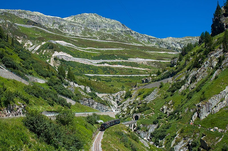
53. Back in 1981, this 18-kilometer stretch of road Furka - Oberalpban after the opening of the tunnel under the pass Furka was closed and abandoned, but only after 11 years thanks to the initiative of enthusiasts and their donations earned again.
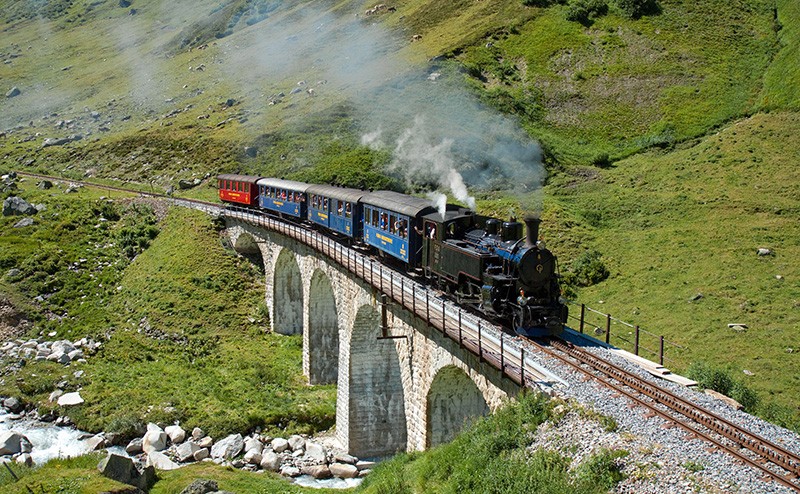
55. In fact, it is a tourist attraction, where participants have the opportunity to pass on the second highest railway pass in Europe, on the road to enjoy the alpine scenery and do this with a hot lamp furiously fumed locomotive.
Rhaetian Railway - the most mountainous traditional railway line in Europe
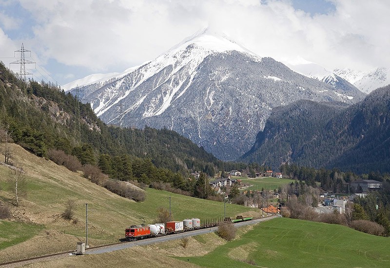
56. There are in Switzerland and outstanding in all respects conventional railway, which for the operation no longer requires additional gear. The slopes are not so great, but the extent of their much higher and also the tourist, and they perform the usual transport function.
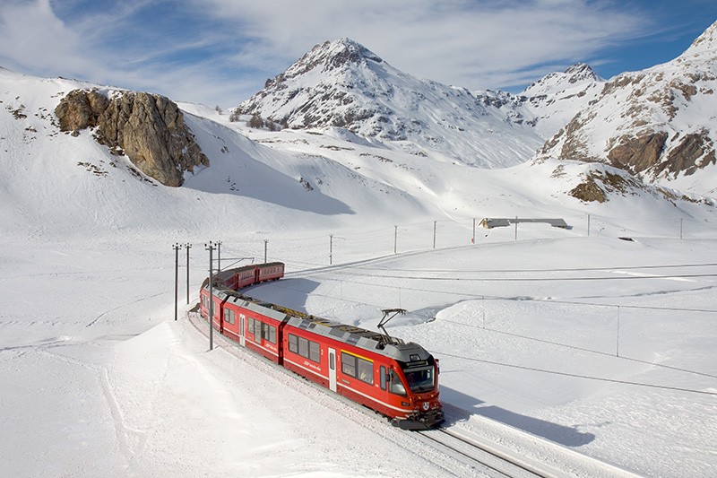
58. In 2008, the Albula and Bernina lines of the Rhaetian two railway largest narrow gauge network in the southeastern canton of Graubünden, included in the list of World Cultural Heritage by UNESCO.
59. The authoritative international organization noted their outstanding engineering solution allowed to join the European transport network previously inaccessible areas of the central Alps.
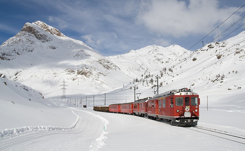
60. Until the 1890s, the railways in the south-east of Switzerland is practically absent. Only in the years 1898-1904 was opened Albula line (67 km), and in 1910 - its continuation of the Bernina (61 km) associated "big Switzerland" with the Italian town of Tirano through mountain resort of St. Moritz.
61. This project has breathed new life into the principle canton of Grisons, allowing him to become one of the main tourist centers of the country.
62. Beginning in the village at an altitude of 697 Thusis meters above sea level, the road climbs on the Bernina Pass (2253 meters) and then descends again to the Italian border in the town of Tirano and ends at around 429 meters. The slope is not greater than 7%, which eliminated the use of the gear. In terms of device movement Albula and Bernina lines quite traditional, except that the narrow-gauge (width - 1000 mm). Only in some localities they are just on the city streets, resembling rather the tram.
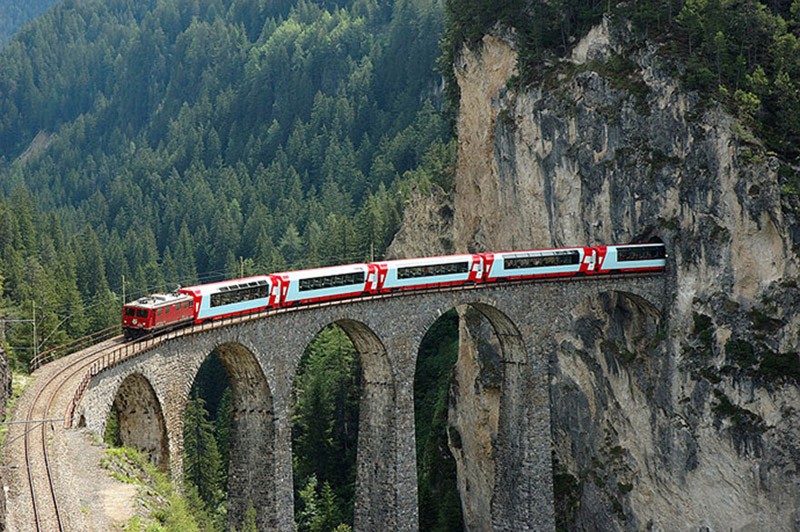
63. In total, at the turn of the XIX and XX centuries was built here 55 tunnels (including spiral) and cloisters, 196 viaducts and bridges.
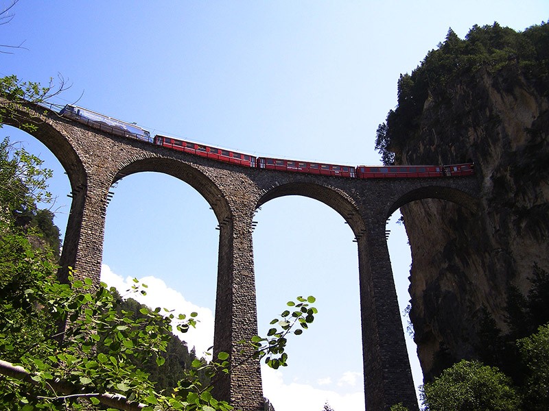
64. Among the prominent engineering structures allocated Landwasser Viaduct, shestiarochny curved bridge, one end abuts the tunnel. This is a true symbol of the Albula line.
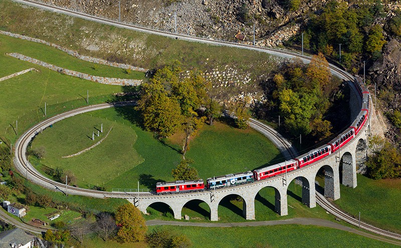
65. In line Bernina its symbol - spiral viaduct Brusa. It was constructed to compensate for the height difference and taking into account that the maximum gradient of the road should not exceed 7%.
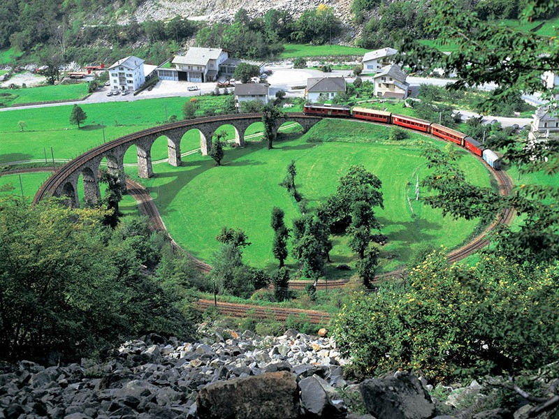
66. Stimulated engineering solution has become one of the most unusual railway facilities in the world.
67. Since the mid-1980s, and especially after the lines in the list of UNESCO WCS Albula and Bernina lines have become especially popular among tourists. On the roads goes several trains with cars that have panoramic windows. For example, Bernina Express just 4 hours overcomes the 127 kilometers between Chur and Tirano, first rising to 1700 meters, and then going down for 1800.
69. Alpine passes, mountain lakes, pastoral towns with Kirch and inaccessible peaks, glaciers and piedmont station, curved viaducts and kilometer tunnel - all of this can be seen with the help of the Swiss railways.
70. Built over a century ago, they still represent a remarkable triumph of human genius, the unity of nature and breathtaking engineering marvel.
73. See also: 7 fastest rail lines
'세상만사(국내외 토픽)' 카테고리의 다른 글
| [스크랩] 산 중앙에 구멍이 나있는 노르웨이 Torghatten산 (0) | 2014.11.10 |
|---|---|
| [스크랩] 핀란드 `사우나 뗏목` (0) | 2014.11.10 |
| 수상스키 타며 숭어 잡기 (0) | 2014.11.10 |
| Solar Grill cooks delicious food for 20 minutes (0) | 2014.11.10 |
| 어떤차던지 suv로 바꿔주는 무한궤도 시스템 (0) | 2014.11.10 |


